 |
 |
 |
In the beginning
What was to become Hampton Hill was originally the southern corner of Hounslow Heath, used as common land to graze animals. It was a haunt of highwaymen and footpads, with a gibbet for the punishment of these criminals on the corner at the Hampton Hill end of Burton’s Road. The Commons Enclosure act of 1811 allowed parts of this heathland to be enclosed and the land, which is now between St James’s Church and Hampton Hill High Street, was converted into glebe (land providing income for a clergyman) for the benefit of St Mary’s Church, Hampton.
During the early 1860s the Thames Valley Railway Line was extended, the Hampton Water Works was built and the local nursery trade developed. These projects brought an enormous number of rowdy, hard drinking labourers and artisans into an area with terrible conditions, many people living in “miserable hovels”. They helped to increase the number of public houses in the district to thirteen, these being the scenes of not a few “public affrays”. There were no facilities or services in the area and consequently poverty, drunkenness and violence were widespread. The shacks in which these people lived gradually developed into a community on the common and it was described as “a wilderness with a number of habitations of the most wretched kind, inhabited by a still more wretched class of people”.
Why was St James's Church built?
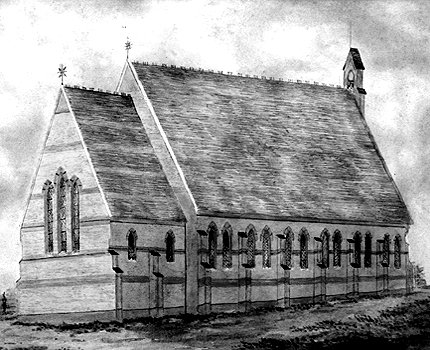
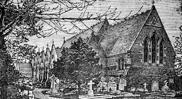
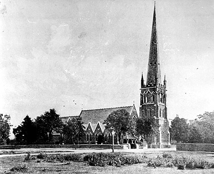
The Revd James Burrows, MA, was appointed vicar of St Mary’s, Hampton, in 1861. Within a year it was decided that a new church, the District Chapelry of St James, should be built to cope with the above mentioned appalling situation and serve the scattered village of New Hampton situated a mile or more away on the hill above Hampton. The mother parish of St Mary’s gave some of its glebe land for this purpose and a simple church, with a nave, a chancel and a small vestry room, was built. When it was finished Revd Fitzroy John Fitz Wygram was appointed vicar, and the building was consecrated on December 11th, 1863, by Bishop Tait, Bishop of London.
The Common, as our area was then called, was described as “a miserable area inhabited by an even more miserable brand of people” and the little district chapelry of St James as “a barn of a church in a wilderness of a parish”. Revd Fitz Wygram and his wife devoted their lives and much of their fortune in improving the living conditions and prospects of the parishioners. Consequently, matters speedily improved and people started flocking to worship in the little church.
History Topics
Clergy & PCC History | Services History | Music History | Children History | Outreach History | Church Buildings History | Churchyard History | Churchyard Records | Magazine Archives
Find out more
The Birth and Growth of Hampton Hill (documents)
New Hampton and Hampton Hill in Victorian and Edwardian Times (document)